 полная версия
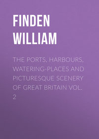
The Ports, Harbours, Watering-places and Picturesque Scenery of Great Britain Vol. 1
SHIELDS. ENTRANCE TO THE HARBOUR
The view of the entrance to Shields Harbour is taken from the bank a little below the Spanish Battery, on the north side of the Tyne, and about a quarter of a mile to the south-westward of Tynemouth lighthouse. To the left, a part of South Shields is seen, with a vessel "dropping up" the Narrows, just before entering the harbour. Towards the middle of the Engraving are the two lighthouses at North Shields – distinguished by their flag-staffs – which, when taken in a line, are a guide for vessels in passing the bar. To the right of the low lighthouse is Clifford's Fort, enclosed by the line of embrasures, and commanding the entrance to the harbour. To the right are the banks, of clay, which extend from the Spanish Battery to the Low Lights, and upon which the sea is every year gradually making encroachments. The present Engraving, independent of its beauty as a work of art, possesses the merit of containing the only correct view of the entrance to Shields Harbour which has hitherto appeared.
That portion of the river Tyne which may be considered as Shields Harbour is about a mile and a half in length, supposing it to commence at the Low Lights, on the north side, and to terminate at the lower end of Jarrow Slake, at the head of South Shields; its direction is from east by north to west by south; and the towns of North and South Shields are built on the banks and by the shore on each side of it. As the Low Lights are about a mile within the bar, the swell of the sea is not felt within the harbour.
The river is of unequal width, being in some places not more than 400 yards broad, while in others, when the sands are covered with the tide, its width is upwards of 600. From the shoals and varying width of the river, the velocity of the current differs with the breadth of the harbour. Opposite to the New Quay at North Shields, the average velocity in the middle of the tide-way is, at half flood, about three miles an hour; and, at half ebb, about three miles and three quarters an hour. As the easterly wind blows directly into the harbour, vessels formerly were often hindered from getting out to sea, even in fine weather, when the wind was in that quarter, more especially if they were of considerable draught of water; for frequently before such a vessel could drop down with the ebbing tide as far as the bar, there was not sufficient depth of water on it to allow her to proceed to sea. The general introduction, however, of steam-boats for the purpose of towing vessels, when the wind is shy or contrary, has, in a great measure, remedied this inconvenience, and vessels now proceed to sea at any time, in favourable weather, when there is a sufficient depth of water on the bar.
The town of South Shields is very irregularly built; and the principal street for business extends from the market-place to the lower end of the town. The market-place, in the centre of which stands the town hall, is spacious, but the market is very indifferently supplied with every thing except fish. Westoe, anciently Wivestoe, is a pleasant village about a mile southward of South Shields, where several ship-owners and persons of property reside. Jarrow, so famous in days of yore for its monastery, is about a mile and a half to the westward of Westoe; and in the vestry an old chair is still preserved, which is said to have been the seat of the venerable Bede.
The town of North Shields lies on the north side of the river Tyne, and is in the county of Northumberland. The principal street for business, and which may be considered as forming the greater part of the old town, is the Low-street, running nearly parallel with, and at a short distance from, the river, and extending from the New Quay to the Low Lights. The greater part of the town, which is built on the bank top, extending in regular streets towards the north, has been erected within the last fifty years.
At the New Quay there is a commodious wharf, with warehouses at each end, where trading vessels load and unload, and where steam-boats leave for Newcastle. A little above the New Quay is the landing for the steam ferry-boat, which plies between North and South Shields, and leaves each place four times an hour, from seven in the morning till dusk, carrying passengers across the river at the charge of a penny each. This ferry, which was only established in 1829, is a great accommodation to both the towns. Previous to its establishment, the conveyance of sheep, cattle, and horses across the Tyne, in an awkward flat-bottomed boat, managed by a single man, was attended with great inconvenience. The barge steam ferry-boats now employed are surrounded with a strong railing; and sheep, cattle, and horses can be driven on board with little trouble, and conveyed across the river without risk.
NEWCASTLE UPON TYNE
The view of Newcastle is taken from the Gateshead shore, on the south side of the river Tyne, about a quarter of a mile below the bridge. From the point chosen by the artist, a better and more characteristic view of the town is obtained than from any other station. The line of vessels, extending from the right of the engraving to the bridge, indicates the quay – the longest in England, except that of Yarmouth – and which, on a Saturday, when the country people come in to market, is one of the most crowded thoroughfares in the kingdom. The steeple that rises above the houses to the right is that of All Saints. Between All Saints and the Castle – which is distinguished by its modern turrets and battlements – is the famed steeple of St. Nicholas; this the Rev. Dr. Carlyle, vicar of Newcastle, in 1804, declared to be, in his opinion, "the most beautiful fabric existing in the world: surpassing the Cathedral of St. Sophia, at Constantinople; the Mosque of Sultan Saladin, at Jerusalem; the Church of St. Peter, at Rome; and even the Temple of Minerva, at Athens." The modern building, with a Grecian portico, in front of the Castle, is the County Court, where the assizes for the county of Northumberland are held. The Exchange is hidden by the sails of the large vessel, towards the middle of the engraving; and the bridge excludes a view of the Mansion House, which stands in friendly neighbourhood with a glass-house and a soapery, in a narrow street, with a most expressive name – the "Close."
The town of Newcastle, though its present name is not older than the reign of William the Conqueror, claims to be a place of great antiquity. The Roman Wall – which extended from Wallsend, about four miles eastward of Newcastle, to Bowness on the Sands, in Cumberland – crossed the site of the present town; and it is certain that there was a Roman station here, the southern wall of which probably ran along the high ground overlooking the river in front of the old castle. In the list of stations, with their garrisons, on the line of the wall, as given in the Notitia, Pons Ælii occurs as the next station to Segedunum; and our best informed antiquaries appear to agree in assigning the latter name to the station at Wallsend, and the former to the station at Newcastle. The name Pons Ælii, however, occurs in no other ancient work as the name of a station on the line of the wall, and no inscription has been discovered which might confirm the opinion of its being the name of the station at Newcastle. Different writers also have interpreted the list of stations in the Notitia from different ends, and at the present time the situation of several places remains undecided.
The Tyne is navigable as high up as Newcastle, about ten miles from its mouth, for vessels of 250 tons burden, though in some places between Newcastle and Shields, even in the middle of the stream, its depth does not exceed four feet at low water. A little below Hebburn quay, about half-way between Newcastle and Shields, it is not unusual to see three or four small steam-boats, which do not draw more than three feet water, lying aground in the very mid-channel at the last quarter ebb, and waiting for the flood tide to set them afloat. A few years ago, the corporation of Newcastle, as conservators of the river Tyne, employed a steam-boat to scratch away the sand in shallow places, by means of a kind of harrow, which she towed after her. Since the accession of the present corporation to office, a dredging machine has been employed, and if they proceed in their plans for the improvement of the river as they have begun, they will merit the thanks of every person interested in the trade of the town.
But, however praiseworthy may be their efforts for the deepening and cleansing the bed of the Tyne, the present year (1853) has exhibited melancholy testimony that the streets, lanes, and alleys of Newcastle call aloud for the expenditure of the municipal funds – if the lives of the inhabitants are not of less value than the commerce of the port. The ill-drained and badly-ventilated dwellings of some of the more densely-peopled portions of the town have suffered more from the attacks of cholera than any other place in the kingdom.
The chief exports from Newcastle, besides coals, are pig and sheet lead; anchors, and chain cables, with other articles of wrought iron; bottles, plate and crown glass; brown and white paper; common leather gloves, manufactured at Hexham; leather; hams and butter; grindstones, obtained on Gateshead Fell; fire-bricks; alkalies; soap; and Epsom salts. This list comprises the principal articles which constitute the cargo of a Newcastle trading vessel proceeding to London.
BLYTH
The view of Blyth, or more properly of the entrance to the harbour, is taken from the north side of the river, and looking towards the south-east. The cottages seen in the foreground are in North Blyth, which consists only of a few houses, chiefly occupied by fishermen and pilots. On the opposite side of the river are seen the lighthouse of stone, and the "basket light" to the left of it, in which lights are exhibited at night when there is eight feet water on the bar.
Blyth, which is a small seaport town on the coast of Northumberland, and about thirteen miles north-east of Newcastle, derives its name from the river Blyth, on the south side of which it is built. The principal trade of Blyth is in coals, of which more than 120,000 tons are now annually exported. The earliest notice of Blyth as a harbour occurs in Bishop Hatfield's Survey in 1346, from which it appears that the Bishop of Durham claimed fourpence for every ship which anchored there, and that the sum received for that year was 3s. 4d. At what time the coal-trade was first established there is uncertain, but so early as 1610 a complaint appears to have been made to Parliament on account of a late imposition of a shilling a chalder levied on coals shipped at Blyth and Sunderland, "not by virtue of any contract or grant, as in the coals of Newcastle, but under the mere pretext of his majesty's royal prerogative." In 1624, Blyth is again mentioned in a proclamation, as a place exporting sea-coals; and in 1643 an order of Parliament prohibits ships from bringing coals or salt from Newcastle or Blyth, as those places were then in the hands of the Royalists.
Within the last forty years the trade of Blyth has much increased in consequence of the opening of new collieries in the neighbourhood. A commodious dry dock was formed in 1811; and there are several slips for the building and repairing of ships. A considerable quantity of articles of cast and malleable iron, manufactured at Bedlington, about three miles up the river, are shipped at Blyth.
Blyth is a member of the port of Newcastle; and a number of vessels belonging to persons residing there are registered at the latter port. Nearly the whole of Blyth is the property of Sir M. Ridley, Bart. At spring tides there is about fourteen feet water on the bar, and about twelve at neaps; but at low water the bar is nearly dry.
It may be interesting to contemplate a few facts and figures in connexion with that trade which forms the principal occupation of Blyth and its neighbouring ports. From the evidence of an experienced coal-engineer,7 given a few years since before a Parliamentary Committee, we learn, "that the number of persons employed under-ground on the Tyne are – men, 4,937; boys, 3,554; together, 8,491: above-ground – men, 2,745; boys, 718; making 3,463: making the total employed in the mines above and below ground, 11,954, which in round numbers I call 12,000, because I am pretty sure there were some omissions in the returns. On the river Wear, I conceive there are 9,000 employed; making 21,000 employed in digging the coal, and delivering it to the ships on the two rivers. From the best calculations I have been able to make, it would appear that, averaging the coasting-vessels that carry coals at the size of 220 London chaldrons each vessel, there would be 1,400 vessels employed, which would require 15,000 seamen and boys. I have made a summary. There are, seamen, 15,000; pitmen and above-ground people employed at the collieries, 21,000; keel-men, coal-boatmen, casters, and trimmers, 2,000: making the total number employed in what I call the Northern Coal Trade, 38,000. In London, whippers, lightermen, and so forth, 5,000; factors, agents, &c., on the Coal Exchange, 2,500; -7,500 in all, in London. Making the grand total in the North country and London departments of the trade, 45,500. This does not, of course, include the persons employed at the outports in discharging the ships there."
TYNEMOUTH. VESSEL ON THE ROCKS
The engraving presents a view of a vessel on the rocks, at the foot of the cliff, to the north-east of Tynemouth castle, as seen from the Ox-fall, in coming from Cullercoat Sands. On the top of the cliff is the lighthouse; in the foreground are various indications of a wreck; towards the middle of the engraving is the vessel "high and dry" upon the rocks; and in the distance, on the left hand, is seen Souter Point, in the county of Durham, about four miles distant from Tynemouth.
The village of Tynemouth, which gives name to an extensive and populous parish, is situated near the mouth of the river Tyne, at the southern extremity of the county of Northumberland. It is a short mile distant from North Shields, about nine miles to the eastward of Newcastle, and two hundred and seventy-six from London. It consists chiefly of one wide street, which runs nearly east and west, with one or two smaller streets to the northward, nearly in the same direction.
The ruins of Tynemouth priory, which, with the adjacent lighthouse, form one of the most conspicuous landmarks on the eastern coast of England, lie to the eastward of the village. The priory is built on a small rocky peninsula, which is bound, from south-west to north-east, by a steep and lofty cliff; and the entrance to this enclosure, which is of about six acres area, is through the gateway underneath the castle. The whole of the enclosed space is fortified according to the rules of modern defensive warfare, and a party of artillery are always stationed at the castle. There is a public walk round the whole of the castle-yard; and the view of the coast, looking either to the north or south, is extremely interesting. From the top of the lighthouse, which stands at a short distance to the north-east of the priory, the Cheviot Hills, on the borders of Scotland, can be plainly seen; and, looking southward, the view extends across the Durham coast as far as Huntcliffe Fort, in Yorkshire; and, in very clear weather, Flamborough Head, which is about seventy-two miles distant, may be perceived.
Although the present castle of Tynemouth, the appearance of which has been considerably altered within the last thirty years, may not be of very great antiquity, yet it is certain that Robert de Mowbray, in 1095, when he entered into a conspiracy to dethrone William Rufus, had a castle at Tynemouth, and that he converted the peninsular area on which it was built into a place of great strength. After a siege of two months, the castle was taken by the king, and the earl escaped to Bamborough. Mowbray, subsequently, being pursued by the king's party, when endeavouring to gain admission into the castle of Newcastle, took sanctuary in Tynemouth church, from which, however, he was dragged by his enemies, and made prisoner.
In 1090, Malcolm III., King of Scotland, and his son Edward, having been slain when besieging Alnwick, were interred at Tynemouth. In 1298, Edward I. visited Tynemouth, and offered a clasp of gold at the shrine of St. Oswald; and, in 1303, his queen resided there while he proceeded into Scotland. In 1381, some monks of St. Albans, who had been engaged in Wat Tyler's insurrection, fled to Tynemouth for refuge on the death of their leader. On the suppression of Tynemouth priory, by Henry VIII., in 1539, the monks were possessed of twenty-seven manors in the county of Northumberland, with various advowsons, impropriations, and other property, both in that county and in Durham. Their annual revenue was valued by Speed at £511 4s. 1½d.; and by Dugdale at £397 10s. 5½d.
The church of Tynemouth priory continued to be used for divine service till about 1659, when, in consequence of its dilapidated state, the foundation of a new church was laid, near to North Shields, on the Newcastle-road. In the reign of Charles II., the lead was stripped off the roof of the old church, by Colonel Edward Villiers, then governor of Tynemouth castle, who also pulled down part of the priory, in order to obtain stones for the erection of a lighthouse and other buildings.
By a grant from Charles II., dated 30th June, 1677, Colonel Villiers, in consideration of building the lighthouse and providing a light, was authorised to demand one shilling from each British, and sixpence from each foreign, vessel entering the Tyne. Since the time of Colonel Villiers, the lighthouse has undergone considerable alterations, and it has also been greatly elevated. Its correct geographical situation is – north latitude, 55° 0' 55"; west longitude, 1° 24' 31". The light, which is a revolving one, is displayed from sunset to sunrise, and may be seen, in clear weather, at the distance of five or six leagues. The light appears in its greatest lustre, like a star of the first magnitude, once a minute; its brilliancy then begins to decline, and at length it becomes totally obscured.
CULLERCOATS
In the Engraving is given a view of Cullercoats, as seen from the southward. On the sand, in the foreground, is a coble, a light kind of boat, generally employed by the fishermen on the coast of Northumberland; near the coble, to the right, is a dand or buoy, used by the fishermen to mark the place where they have cast their lines or nets. It is formed of an inflated bag of tanned skin, through which a light pole passes, and to which pole the ends forming the openings of the bag are tightly tied with cord. The lower end of the pole is sometimes rendered heavy by lead, so that the dand may float upright, and it has also a loop, or a ring, to which the rope connecting it with the nets or lines is fastened; and a piece of bunting, or coloured cloth, is attached, as a small flag, to the upper end, in order that it may be more perceptible at a distance.
The village of Cullercoats, which lies about a mile to the northward of Tynemouth, is mostly inhabited by fishermen. The duties performed by the wives and daughters of the Cullercoats fishermen are very laborious. They search for the bait – sometimes digging sand-worms in the muddy sand at the mouth of the Coble-dean, at the head of North Shields; gathering muscles on the Scalp, near Clifford's Fort; or seeking limpets and dog-crabs among the rocks near Tynemouth; – and they also assist in baiting the hooks. They carry the fish which are caught in North Shields in large wicker baskets, called creels, and they also sit in the market there to sell them. When fish are scarce, they not unfrequently carry a load on their shoulders, weighing between three or four stone, to Newcastle, which is about ten miles distant from Cullercoats, in the hope of meeting with a better market. The fish principally caught by the fishermen of Cullercoats are codlings, cod, ling, (Gadus molva), halibut, usually called turbot in Northumberland, haddocks, and whitings. Herrings are also taken in the season; and the colesay (Gadus carbonarius), is occasionally caught, but it is a fish which is hardly worth the bait, as it is scarcely saleable at any price. The most valuable sea-fish caught by the fishermen of Cullercoats, is the bret, or turbot of the London market. But this fish, when caught by them, is mostly sold to the bret smacks, by which it is conveyed to London. Gentlemen residing at Cullercoats or Tynemouth during the bathing season, may often obtain excellent sport in fishing for whitings, in fine weather, off the north-eastern end of the Herd Sand. The best time is in the evening, towards high-water; and the best bait is sprats cut into small pieces; it is no extraordinary feat for a party of three, with half a dozen lines, to take twelve or fifteen dozen of whitings in three hours, on a summer's evening.
For the amateur sea-fisher, in the neighbourhood of Tynemouth, there is no bait generally so good when fishing within six or eight miles of the shore, as the small dog-crab, called in the neighbourhood of Shields a pillan. It is known from the common dog-crab by the facility with which its shell may be stripped off; for instance, in breaking the shell round one of its claws, the broken portion may be withdrawn from the member as a glove from the hand; and the shell of the back may also be stripped off in the same manner. From this facility of peeling, it is probable that the crab derives its local name of pillan. Pillan, however, are not plentiful; and when such are not to be got, then sand-worms, muscles, and common dog-crabs are the most likely bait. Codlings and rock-codlings are plentiful a little to the eastward of Tynemouth; but, haddocks and cod, the staple of the Cullercoats fishermen, are not often caught in any great quantity within seven miles of the shore. The young of the colesay, called a hallan, a beautiful little fish, is frequently caught with a rod, from the rocks in the neighbourhood of Tynemouth. The weaver, (Trachinus draco,) or stinging-fish as it is called at Shields, is often caught when fishing off Tynemouth Bar; and strangers, who are unacquainted with the formidable character of this little fish, are sometimes pricked by it when taking it off the hook. The men who are employed in the salmon fishery, at the end of the Herd Sand, have sometimes their bare feet stung by it when hauling their nets. The average length of this fish, as caught at the mouth of the Tyne, is about five inches; though some are occasionally caught there three or four inches longer. The dangerous spines are those of the first dorsal fin; and the best remedy for the wound is to rub it well with sweet oil.
Cullercoats is a kind of land-mark for vessels leaving Shields Harbour; for as soon as the man at the helm can see the village opening behind Tynemouth Cliff, the ship is over the bar.
DUNSTANBROUGH CASTLE, FROM THE EASTWARD
Dunstanbrough Castle, in the county of Northumberland, is situated about seven miles north-east of Alnwick, and about two miles north by east of Howick, the seat of Earl Grey. Of the keep there are no vestiges remaining; and it is even questionable if it was ever completed. Thomas, Earl of Lancaster, who is generally considered to have been the founder of the present castle, only obtained the king's licence to crenelate, or fortify, his house at Dunstanbrough in 1316: and as he was beheaded at Pontefract in 1321, and in the intermediate years had been much engaged, in the south, in rebellion against Edward II., it is not unlikely that the keep might be unfinished at his decease, and never afterwards finished. Of Dunstanbrough Castle history records little that is interesting. In 1464 it was held, after the battle of Hexham, for Henry VI., by Sir Peter de Bressy, and a party of Frenchmen; but was taken, after a vigorous defence, by Ralph Lord Ogle, Edmund and Richard de Craster, John Manners, and Gilbert de Errington, all Northumbrians, and partisans of Edward IV. From this period the castle, which was dismantled by the victors, is never mentioned in the history of the county as the scene of any memorable event. It was in the possession of the crown in the 10th of Elizabeth, but was granted by James I. to Sir William Grey, afterwards Lord Grey of Wark. It is now the property of the Earl of Tankerville, whose ancestor, Charles Lord Ossulston, became possessed of it in 1701, through his marriage with the daughter and heiress of Lord Grey, Earl of Tankerville, son of Lord Grey of Wark.