

Полная версия
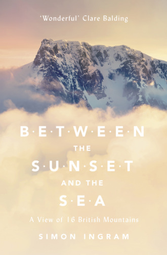
Between the Sunset and the Sea: A View of 16 British Mountains
From Beinn Dearg’s little-trodden high point, the view of Liathach (the ‘Grey One’, probably in reference to its quartzite scree) is spectacularly vivid: a long battlement of peaks resembling the cardiograph of a racing heart. From the main road in Glen Torridon it’s just a lump. You have to walk miles to see this, and to view it at its best you need to climb. It’s the reward you get for being intrepid: a great sight, and once seen, your perspective of scale within Britain’s humble little archipelago may well shift for good. Amongst mountain walkers, Liathach is famous, and much coveted as a prize. But the view I was getting from Beinn Dearg was much rarer – an unbeatable vantage point that, as I’d found, was no easy win itself. But I’d made it. Here I was, for the second time, on the summit of Beinn Dearg: the culmination – and exact halfway point – of a 1,000-mile round trip.
There was the summit marker cairn: a modest, human-piled heap of native rocks, one the shape of an incisor tooth poking out of the top to the height of my shoulder. Within that cairn – somewhere around the height of my hip – was the 3,000-foot contour line.
And herewith lies the great irony of Beinn Dearg, and the third reason I’d chosen to climb this mountain above all others hereabouts. Beinn Dearg is considered the least noteworthy of Torridon’s central quartet of mountains, not for lacking challenge, nor spectacle, nor location: it has all of these in plenty. Despite being the nucleus of the area that contains Liathach, Beinn Eighe and Beinn Alligin, the mountain is ignored by the bulk of human traffic because it’s 30 inches too short. Thirty inches: that’s the distance between the sole of my boot and the middle of my thigh. You cannot imagine how spectacularly, how ridiculously insignificant that is in mountain terms. A 3,000-foot mountain is 36,000 inches high; 30 inches represents 0.08 per cent of its total height. On a 6-foot person, that’s the equivalent of cutting just under two millimetres of hair from the very top of their head, then dismissing them for being inconsequentially small. The reason for this is that 3,000 feet is quite an important measurement for a mountain in Scotland; it’s the height at which a mountain becomes a Munro.
There are, at the time of writing, 282 Munros in Scotland. I say ‘at the time of writing’ – new mountains don’t appear or disappear at a rate necessary to be monitored by hillwalkers, after all – because nobody can really decide what actually constitutes a Munro. The original list was compiled by a London-born, Scottish-raised baronet, Sir Hugh Munro, as a way of categorising the hills of his familial homeland into some sort of quantifiable system. It was published in 1891, and surprised most by its sheer length; most people thought Scotland harboured a mere handful of mountains over 3,000 feet, so the whole thing was a splendid surprise.
But despite being thorough, Munro wasn’t particularly specific. His Tables reflected what he considered ‘separate mountains above 3,000 feet’, but he neglected to define what constituted ‘separate,’ and this is of course unsatisfactory for today’s levels of numerical scrutiny. Alas, much quarrelling continues about which peaks should and shouldn’t be on the list, and it all gets terribly complicated. The debates on the matter are filled with terms such as ‘overall drop’, ‘relative height’ and ‘subsidiary tops’, which all broadly circle around the fact that nowhere did Munro give a specific figure for how tall a summit had to be in relation to the one next to it to qualify it as a separate mountain – and therefore a true Munro.
The reason this all matters is that ‘bagging’ the Munros, as well as subsequent (and generally rather more specific) mountain lists such as the Corbetts, Grahams, Hewitts and Marilyns – not forgetting the Lake District hills chronicled by celebrated guidebook scribe Alfred Wainwright – has become a way of quantifying experience and achievement, a means of systematising and categorising something which, by its nature, is the antithesis of order and reason: walking into the wilderness, and climbing up something for no other motive other than you can. And – of course! – because it’s there.* Frustrating, annoyingly pedantic and wonderfully idiosyncratic. In short, splendidly British.
As of May 2013, some 5,000 people have completed all of the Munros, some of them having done so twice, a few without stopping. That’s an awesome achievement. Superhuman, even.
Yet how many of those people looked up at Beinn Dearg, saw it, and thought: ‘Wow! But not on my list,’ before shuffling on?
It’s all a lot of fun and certainly makes a pleasingly functional answer to the perennial question ‘Why climb a mountain’ (Answer: ‘I’ve got them written down on this piece of paper, so I have to’). And whatever legacy Hugh Munro left when he died of influenza in 1919 – presumably without someone sitting anxiously at his bedside imploring him to write a number, any number, down on this piece of paper before you go, old chap, because one day this could be important – you have to admire his style. Other than that 3,000-foot criterion, Munro went on instinct rather than anything more mathematical; it was simply a question of how grand a summit felt. And at its core this all brings us back to the argument of what is and what isn’t a mountain. It really doesn’t matter. If it feels like a mountain, then it is one.
I didn’t have time to do the Munros, even if I wanted to. I certainly couldn’t do all the Corbetts, or even the Wainwrights. I admired and envied the experiences of all those who did, but I couldn’t invest the precious time I had to spend in the mountains to one geographical area, and certainly not to the same narrow band of the vertical scale.
Stand on Beinn Dearg’s summit, make a little indentation in your thigh, and take a moment to consider your context – there’s the Atlantic, there’s the river, wriggling along far below, and here you are, alone amongst it – and you’ll realise how little numbers matter when it comes to climbing mountains. Beinn Dearg is a mountain: each and every one of its 35,970 inches builds towards a top of such elevated spectacle, you’d be mad to discount it on any basis, let alone it not making the coveted slate of a man whose life occupied but a flash of its own existence.
I looked at my watch. Six p.m. It had taken far more time than I’d thought to reach the summit and darkness would soon start falling. Cloud was beginning to mither the higher tops, and was creeping up the gullies and valleys around me. Walking out would take hours. Time I got down.
Taking a last look around, I walked south from the summit cairn, intending to follow Beinn Dearg’s skyline as it curved around to the east, then find a comely slope to descend into the valley once the mountain had surrendered most of its height.
Ahead of me, the edge of the summit appeared as a hard line against the sky, like the side of a flat roof or the end of a diving board. I wasn’t alarmed: the convex slopes that built these mountains meant that easy terrain beyond – a broad series of rock steps, or a thin path negotiating a steep slope – would emerge as I got closer.
Only it didn’t. I reached the edge of the summit plateau and froze. For the first time I saw the descent route, and it was a shock. Ahead of me and below was a thin sail of brown, bitten rock. Curved slightly, its outside edge was completely vertical in its fall to the valley floor, whilst the right side – now filling with rising cloud – had a steeply tilting grassy ledge across which a thin path beetled. Beneath that, a crag, then a drop of similar horror. From the top of the mountain down to the first bit of buttress-cut slope was probably in the order of 500 metres. That was the only way the mountain went. I’d two choices: climb the crest on good rock but over big exposure, or traverse the grassy ledge and pray it wasn’t slippery. My company on both of these options would be open intimacy with a drop as high and as vertical as the Empire State Building. I didn’t remember this! And this wasn’t even the most pressing problem.
At my feet – far from an easy toddle down a few amenably angled rocks – was a vertical step of about three metres. Its bottom was a little platform of rock, on either side of which the mountain fell away with fatal steepness. To get to it required a down-climb as if on a very steeply raked ladder, only with tilted footholds of wet rock instead of rungs, with no guarantees of integrity and no margin for error at the bottom. Piece of cake.
I pulled out the map and looked at it helplessly. I’d no phone reception, and no rope – ropes are not necessary to reach the top of all but a few major mountain summits in Britain,* and next to useless unless you have someone with you. This was the way off; the only other option was to go back the way I came, and I didn’t fancy that either. With increasing alarm, I looked around at the clouds and tried to rationalise. The down-climb in front of me looked delicate, but achievable. I must have done it before, though probably under direction and encouragement – and with even a helping hand – from Tom. But I had done it. And confidence was two-thirds of the battle. As long as I didn’t lose my cool I could do it. Just a few feet of down-climbing and a bit of exposure, and I could be on my way to a meal and a bed. Either that, or I’d just have to learn to live up here.
Descents like this are what fatal-accident statistics are made of. Coming down mountains claims more people than going up by a ratio of about 3 to 1. What was worse, I really hadn’t expected this. By ploughing up the hill, waving my previous experience of the mountain as a tool which, as we’ve seen, turned out to be less than reliable, I’d neglected to do enough research. A failure. But a lesson, too – and one I could learn from provided I could safely find a way out of this jam.
Mustering confidence, I fixed my mind on something random. I’d read somewhere that reciting your telephone number backwards during times of fear engaged a part of the brain that antagonistically quelled your fright cells; as I turned to face the rock and placed my foot on the first ledge a few feet down the crack, I shakily began to do it. Three points of contact at all times; look after your hands, and your feet will look after themselves. I could smell the murk of the rock as I pushed my face close to it, trying hard to make my entire world the crack before me and the narrow tube of rock at my feet I had to get down. No mountain, no drop – just this little ladder. Nothing else.
Concentrating on moving my hands to where my feet were, striking the rocks with the edge of my fist to check their stability, and mumbling my reverse phone number aloud with my exhales, I steadily made progress down the crack. I dropped down the last foot, landing squarely on the little platform. My heart audible in my ears, I took a deep breath and continued on down the ridge, not wanting to lose momentum until these dangers were passed.
I rejected the crest of the precarious rocky sail in favour of the lower grassy terrace, moving to the right of the ridge’s frightening-looking apex. Trying to move as smoothly as I could, I traced the skinny path with my eyes then followed it with my feet, taking care – great care – not to trip. Writhing cloud had now clogged the void to the right, momentarily taking away the psychological impact of the drop. It parted as I approached the end, and I caught the glint of the river far below and the edge of Beinn Dearg’s mighty south-west buttress. There it was: that memory, that feeling of height – the kind of feeling that hits you like a nine-iron to the back of the legs. It was exactly what I didn’t need at that precise moment, but I stayed focused for the last few feet of the traverse. Then suddenly it was over. I scrabbled over a few rocks onto a little ledge, and when I saw that the mountain was considerably tamer from here on and that there were no more surprises in store, I let out an audible groan of relief, crumpling against the rock, my legs buzzing, arms shaking, breathing rapidly. That had been unexpectedly hairy.
Although I wasn’t off yet and the descent was still going to be difficult, I now knew that I was going to get down. After that, dinner was going to taste particularly good. I might even have an extra beer to celebrate being able to have an extra beer.
But this was only the first. As it would go, fifteen more mountains lay ahead – each with its own challenge, its own particular conditions, feel and story to tell. Beinn Dearg wasn’t the hardest. It also wasn’t the highest. But for me this was the mountain I’d always associate with this feeling of height; of that elevated perspective you can only get from a mountain, and of the exhilaration and the fear that grips you by the stomach – the basic elements that make these places so special. In 1911 the Scottish-American naturalist John Muir wrote that ‘Nature, as a poet … becomes more and more visible the farther and higher we go; for the mountains are fountains: beginning places, however related to sources beyond mortal ken.’
I rose, and as I did so I pushed my wet hair out of my face and felt a substantial deposit of sharp sandstone grit upon my forehead. Confused for a moment, I realised my hands had picked it up off the rock and I’d wiped it onto my brow every time I’d mopped it. I was literally sweating grit.
My eyes followed the rock at my feet up towards the ridge I’d just climbed. The stuff I was carrying down the mountain on my forehead, these mountains are made of it. That brown, course-grained sandstone is even named after the area best exhibiting it: Torridonian sandstone, they call it. The whole range has rocks made of this grit as their bedrock. It’s why Beinn Dearg is called Beinn Dearg: for the way the sun lights the brown sandstone and deepens it to red in the westerly glow of sunset. It’s famous for this.
But nobody ever tells you about the lichen. Brilliant white whorls of it, augmenting almost every rock. Unless you were on the hill you wouldn’t see it or know it was here. But up on the ridge it’s everywhere. It looks as if the mountain is pinned with white rosettes; silly little patches of prettiness adorning its hard skin.
* Which was of course said by ill-fated climber George Mallory at a lecture in 1923 when asked, ‘Why climb Everest?’ Nobody really knows what he meant, or even if he said exactly this; it could have been something profound, or it might simply have been irritation at the question. Either way, it has passed into history as the most famous three-word justification of the ostensibly pointless.
* Most famously, Sgùrr Dearg’s notorious ‘Inaccessible Pinnacle’ on the Isle of Skye. There are other summits in Britain – indeed, more on Skye – that require the use of a rope, and ability is of course subjective, but there are ways up most of our principal mountains without additional aid, certainly in summer.
PART I
Конец ознакомительного фрагмента.
Текст предоставлен ООО «ЛитРес».
Прочитайте эту книгу целиком, купив полную легальную версию на ЛитРес.
Безопасно оплатить книгу можно банковской картой Visa, MasterCard, Maestro, со счета мобильного телефона, с платежного терминала, в салоне МТС или Связной, через PayPal, WebMoney, Яндекс.Деньги, QIWI Кошелек, бонусными картами или другим удобным Вам способом.
